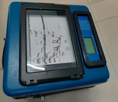
The Single Beam Echo Sounder is a fundamental instrument used for accurately measuring water depth. It is widely employed for conducting bathymetric surveys in rivers, lakes, minor ports, and inland waterways. This instrument is particularly effective in shallow water areas and enables the collection of accurate depth data in a cost-effective manner.
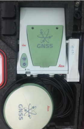
Differential GPS (DGPS) and Real-Time Kinematic GPS (RTK GPS) systems are used to ensure precise positioning for survey data. These systems enable the collection of location data with centimetre-level accuracy, ensuring high precision and reliability in survey operations.
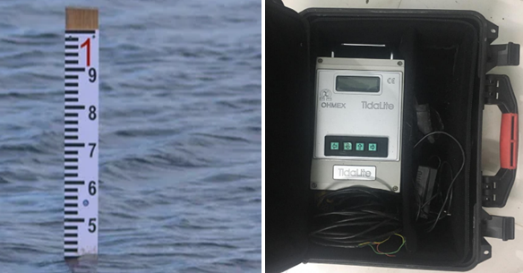
Tide poles and tide gauges are used to accurately record variations in sea level. These instruments are essential for reducing survey data to chart datum and for carrying out tidal analysis.
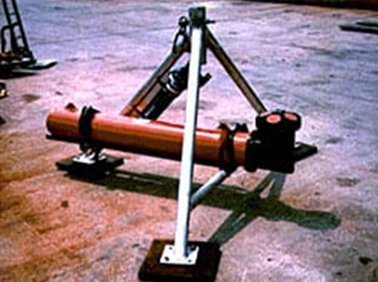
ADCP is an instrument used to measure the speed and direction of water currents in rivers and marine areas. The data obtained from ADCP is widely used for flood studies, river surveys, and sediment transport analysis.
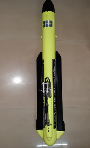
Side scan sonar is a sonar system used to generate high-resolution images of the seabed, coastal bottoms, riverbeds, and shipwrecks. It scans the seabed using sound pulses and records detailed information on its shape, texture, and objects present on the bottom.
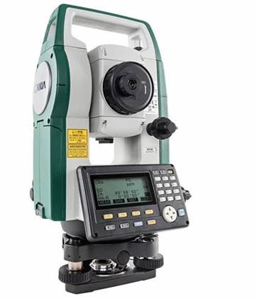
A Total Station is a high-precision instrument used for land-based survey operations. It is employed for shoreline surveys, establishment of control points, and levelling of structures.
An underwater camera is a specialized waterproof imaging device used in hydrographic surveys to visually observe and record conditions beneath the water surface. It complements acoustic survey equipment such as echo sounders by providing real-time images and video of the seabed, underwater structures, and submerged objects.
These cameras are widely used for seabed verification, inspection of ports and harbour structures, post-dredging assessment, and identification of underwater obstructions. By offering direct visual confirmation, underwater cameras enhance the accuracy, safety, and reliability of hydrographic survey operations
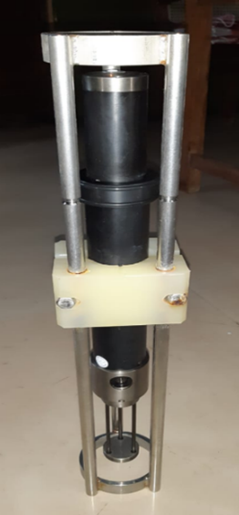
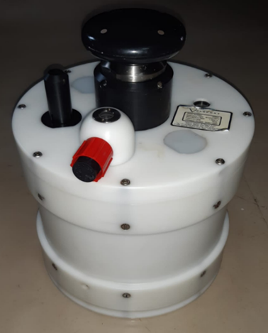
The Sound Velocity Profiler is an oceanographic instrument used to accurately measure variations in the speed of sound at different depths in water bodies. The instrument determines sound velocity based on parameters such as temperature, salinity, and pressure, and plays a critical role in hydrographic surveys.
The Sound Velocity Profiler is widely used to improve depth measurement accuracy in multibeam and single beam echo sounder surveys. It is designed with a robust construction suitable for reliable operation in ports, coastal areas, rivers, lakes, and other inland and marine water bodies.
The Wave Recorder is an oceanographic instrument used to accurately measure and record wave characteristics such as wave height, period, and frequency in water bodies. With its robust construction, the instrument is suitable for reliable operation in coastal, marine, river, and lake environments. It is widely used for collecting wave data required for port development, coastal protection works, dredging studies, and environmental studies.
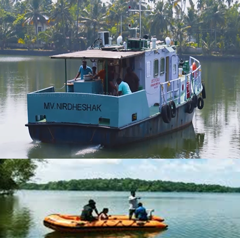
Specially designed survey boats fitted with hydrographic survey equipment are used to conduct surveys in rivers, lakes, ports, coastal areas, and maritime zones. These vessels enable survey operations even in areas that are difficult for conventional boats to access.